Rivers and Water
Water Zones, exploring a river upstream, where a drawn Water Marker goes, the River Chart, adding sources for forks, DP for rivers and sources, and blocked borders.
Water zones
A region is a Water Zone if any of its borders has a Water Marker (or a river printed on the map). Every Port of Entry is a Water Zone thanks to its printed river, and each has a neighbour that is one too, because of the Fork printed on their shared border (treat it as a Fork marker). Water Markers sit on a border, with any arrow pointing downstream.
| Marker | What it is |
|---|---|
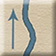 River | The river goes on upstream FAQ FAQ FAQ |
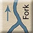 Fork | Two branches upstream: explore each FAQ FAQ |
 Generic Source | A dead end, drawn beside the river or branch FAQ |
| Pictured Sources and rivers | Waterfall, Marsh (river or source), Lake Source, Largest Lake Source, Mountain Source — they score (see below) |
Exploring upstream
When you enter an unexplored region that has a River or Fork on one of its borders, find out where it comes from:
- Draw a Water Marker from the cup. (A Source already on the border is a dead end: draw nothing.)
- If it is a Source of any kind you may return it and draw again; the second draw must be placed. With
 Canoes you may return two Sources in a row; the third draw must be placed.
- A Generic Source goes beside the river or branch it ends, looking connected.
- Anything else goes on a valid border of your region (next section).
- For a Fork, do all this twice, once per branch.
Valid borders
A border is valid when the region across it is neither explored nor already a Water Zone. Water can’t come from a region that is already a Water Zone: a river never splits going downstream.
Where a Water Marker goes
- Unless it is a Generic Source, draw two Color Code Markers; they name two borders of your region.
- Place the Water Marker on whichever of the two is valid (your choice if both are).
- If neither is valid, or the symbols aren’t on your region, choose any valid border.
- Return the Color Code Markers after each placement; for a Fork, repeat for the second branch.
- No valid border at all: draw until you get a Generic Source (two for a Fork) and return the rest. A Fork with only one valid border: draw a marker for it as usual and put a Generic Source on the other branch.
Another way to become a water zone
An unexplored region with no Water Marker may still hold the origin of a neighbour’s river. If an adjacent unexplored region is a Water Zone because of a River or Fork:
- Count that region’s valid borders, plus its border with yours.
- Cross-reference the count with the “River” or “Fork” row of the River Chart on your Expedition Sheet. A Fork that another player has already connected to counts as a River.
- Roll a d6 + d10. At or below the number, the two are connected; “C” means connected without rolling. Two candidates? Try one, and if that fails, the other.
- If connected, draw a Water Marker. A Generic Source: return it and draw again; a second Generic Source means the connection was false. Anything else confirms it: place it on the shared border, arrow pointing downstream into the neighbour.
- Unless that marker is a pictured Source, the river goes on upstream through your region: draw and place as in Exploring upstream.
| Valid borders + 1 | 1 | 2 | 3 | 4 | 5 | 6 |
|---|---|---|---|---|---|---|
| River | C | 9 | 7 | 6 | 6 | 5 |
| Fork | C | C | 10 | 9 | 8 | 7 |
More sources for each fork
The cup starts with 10 sources of all kinds. Every time a Fork is placed on the map, move one Generic Source from the New Sources box into the cup: each extra branch needs an end.
Rivers and sources score
Placing any of these six markers earns 2 DP (Largest Lake Source: 3 DP) and costs 2 Time:
Rulings that apply to every row below: Are the pictured Sources placed on a border?.
| Picture | Water source scoring |
|---|---|
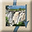 | Waterfall (river): 2 DP; matching Resource adds +1 DP:  Painting. |
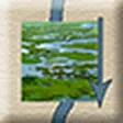 | Marsh (river): 2 DP; matching Resource adds +1 DP: Painting. |
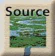 | Marsh (source): 2 DP; matching Resource adds +1 DP: Painting. |
 | Lake Source: 2 DP; matching Resource adds +1 DP:  Surveying FAQ. |
 | Largest Lake Source: 3 DP; matching Resource adds +1 DP: Surveying. |
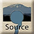 | Mountain Source: 2 DP; matching Resource adds +1 DP:  Altimeter. |
Placing a Generic Source scores nothing by itself, but Altimeter still adds 1 DP. All six draw
the attention of the “Exploring” Patron.
Blocked borders
A Lake Source or a Marsh on a border fills the whole border: it is blocked. Only an expedition with
Canoes can cross it. And whenever you cross a border with no Water Marker (and no printed
Fork), return your Canoes.
Fishing
With  Fishing, add 5 Food at the end of your Map Phase Player Turn if your region is a Water
Zone — once per Game Turn.